Sunday, May 31, 2009

Cruising Hubbard Glacier

Visibility was poor when the ship cruised the Hubbard Glacier on Saturday, as there was dense fog in the glacial passage (thus, we don't have great photos). However, the skies got clear afterward and provided magnificent scenery for the day as we travelled from Valdez to Skagway, Alaska (arriving Sunday morning).

We traverse the Sawyer Glacier on Wednesday, and hopefully can provide better photos, weather permitting. We can see more than the camera captures anyhow so we are not disappointed.

Saturday, May 30, 2009

Climbing the Worthington Glacier in Valdez

On Friday, we set out for a scenic drive to explore the many natural wonders of Valdez. We departed the pier in Valdez for a one-hour picturesque drive to the Worthington Glacier, passing the Keystone Canyon Waterfalls and the Thompson Pass.

Upon arrival at Worthington Glacier State Park, we signed waiver and waiver, and were then outfitted with glacier boots (with metal teeth for climbing the ice), helmets, and ice poles to make the trek up the VERY STEEP glacier. The hike up was about two hours, and many of us wanted to keep going but we had time constraints getting back to the ship before it sailed. We were ultimately able to traverse about one quarter of the massive glacier, but we did get to the top ice field. Our descent was a bit trickier due to deep crevasses (step in one and you go down 100 feet, never to be seen again), and the icy steep incline. We had four guides for 18 people and they were great at securing ropes in the ice when necessary to get to the next level safely.

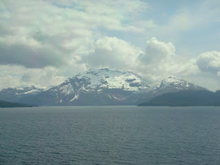
Following our adventure at Worthington Glacier, we enjoyed the sail out of Valdez with incredibly stunning scenery of the snow-capped mountains meeting the sea. Tomorrow we cruise through the Hubbard Glacier en route to Skagway, Alaska.


Friday, May 29, 2009

Seward, Alaska

Thursday (5/28) was a rainy day in Alaska. We docked in Seward to disembark 30 passengers and pick up 40. After saying our goodbyes to friends we had made on the last journey, we just went into town to do some shopping and have lunch on the waterfront at the notorious Ray’s Place. No pictures worth sharing (unless you care to see a sea of fishing boats).

Thursday, May 28, 2009

Homer, Alaska: The Halibut Fishing Capital of the World

Homer rests on the bank of Kachemak Bay, a sheltered arm of lower Cook Inlet. It is known as the “Halibut Fishing Capital of the World.” Snow-capped mountains reaching thousands of feet skyward and glistening glaciers combine to create a scenic backdrop to Homer’s fun-filled fishing port. Just over 4,000 people live and work in the town of Homer, making it a hub of south-central Alaska’s fishing and tourism businesses.


Our adventure for the day was to take a private helicopter tour across Kachemak Bay to view the exhilarating scenery of the bay and Grewingk Glacier. After an hour of enjoying the aerial views of the mountains and the coves, we landed on the glacier to explore the terrain.

However, we were not outfitted to travel far on the slippery slopes. That experience we have planned (to the fullest) for our visit to the Worthington Glacier in Valdez in a few days…


Later in the afternoon, we visited the many, many shops along the quaint Homer waterfront and stopped for a drink in the famous “Salty Dawg Saloon” before returning to the ship.

Wednesday, May 27, 2009

Kodiak, Alaska

Kodiak Island is located on the south coast of Alaska, and is separated from the Alaska mainland by the Shelikof Strait. With a size of 3,465 square miles, it is the largest island in the Kodiak Archipelago, and the second largest island in the United States (the Big Island in Hawaii being the largest). The Russians established a settlement here in 1784, lured by the region’s plentiful fish and sea mammals (particularly the valuable sea otter pelts). When the U.S. purchased Kodiak from Russia in 1867, its economy shifted abruptly from the fur trade and whaling to salmon fishing. It is home to some 700 fishing vessels and the country’s largest Coast Guard station.

Population of the Kodiak Archipelago is about 12,000, but land for housing is scarce with 85% of it naturally preserved by the government. The terrain is very mountainous and there are many deep ice-free bays that provide sheltered anchorages for boats.


We spent the day at exploring the beauty of the island at Fort Abercrombie State Park. We hiked for hours through its wooded trails taking in breathtaking views of the coastline. There were many different types of seabirds, and we were also lucky enough to see whales, seals, otters and an eagle.


The eagle was the only one that cooperated for a decent photo, however.


Next stop is Homer, Alaska.

Monday, May 25, 2009

Back in the U.S.A.

Upon leaving Russia, we spent three days crossing the Bering Sea, which was uncharacteristically smooth, and on Sunday arrived in Dutch Harbor, Alaska (the USA!). This homecoming wasn’t as significant to most on board, as about only 10% of the 380 onboard (100 passengers and 280 crew) are American. But after nearly ten weeks abroad, it was meaningful to us (although we are still not anxious for the trip to end!). Fortunately, we still have about two weeks to go...

Dutch Harbor is one of the Aleutian Islands, a chain of more than 300 small volcanic islands extending in an arc from the Kamchatka Peninsula towards Alaska. These islands were the stepping stones that attracted Russian explorers to Alaska in the 18th century. The U.S. purchased Alaska from Russia in 1867, and bitter campaigns were fought here between American and Japanese forces during World War II.

We made a brief stop in the city of Unalaska, Dutch Harbor, located at Unalaska Island at the end of the Aleutian chain. Unalaska is a community of about 4,000 residents, and as one of America’s busiest commercial fishing ports, almost 90% of its workforce is economically dependent on the fishing industry. “Town” consisted of a Safeway store, gas station, museum, and a hotel with a restaurant and gift shop. The locals were very friendly, and we enjoyed a delicious fresh king crab lunch at the hotel, afterwards stocking up on some essentials at the Safeway (it was great to see brands we recognized!). We have eight more destinations and many more exciting adventures in Alaska to come.

Friday, May 22, 2009

Stepping Foot on Russian Soil

It felt like Christmas morning when we awoke yesterday* (Thursday) to the beautiful view of snow-capped Russian mountains. We were in the port of Petropavlovsk, a city that has the largest settlement on the Kamchatka Peninsula. During the Soviet Era, this remote Far East Russian outpost served as the submarine base of the Pacific Fleet. Today, it is dominated by the fishing industry, with trawlers bringing in a million tons of fish each year. It is a rare occasion for a cruise ship to make a stop here.

By all appearances, Petropavlovsk seemed to be behind the times. In fact, a fellow traveler from Germany commented that it reminded him of the condition of his country in the eighties. Most buildings and roads were in a state of disrepair. But we nevertheless got the chance to step foot on Russian soil, and experience a bit of its culture, at a local restaurant.


After a welcome drink of Russian champagne, we were entertained with a performance of traditional Russian folk songs and dances by several groups of children and adults.


We then had a cooking demonstration and a tasting of locally brewed beer, following by lunch featuring traditional Russian dishes. Following lunch, we took a drive up the mountainous terrain for some spectacular views of the sea and volcanoes in the distance. It was a pleasant afternoon and we are now heading due east across the Bering Sea. Our destination: Alaska!


*Note: “Yesterday” was actually 48 hours ago as we crossed the international date line on May 22 (in Latitude 53°08´ North and Longitude 169° 36´ East), and thus experienced Friday twice...

Tuesday, May 19, 2009

Hokkaido Island, Japan

On Sunday and Monday, the ship made stops at two other Japanese ports, Hakodate and Kushiro, both located on Hokkaido Island.

Hakodate is located on the southern part of Hokkaido Island, and is Hokkaido’s third largest city with a population of just under 300,000 residents. It has a provincial charm to it, and one can supposedly see stunning views from the summit of Mount Hokodate, although it was raining and we did not make the trip. Instead, we visited the Hakodate Morning Market, an open-air fresh seafood market with easily over 400 tightly-packed storefronts selling the daily catch. Most memorable were the two- foot giant crabs pictured at right.

The Morning Market is located within the recently developed “Red Brick Warehouse” waterfront region, where old warehouses of red brick have been remodeled to house bars and restaurants. We found a number of shops selling very unique glassware and wood carvings, and came “home” (or back to the ship, but we call it home these days) excited about our purchases.

On Monday, we arrived further north at the port of Kushiro. Kushiro is the main port of Hakkaido and the island’s only ice-free trading port. It is also a major base for fishermen, and had its own version of the seafood market at the Fisherman’s Wharf called MOO. The downtown area was honestly not that exciting, but we did find a great little local sushi restaurant where we struggled to order as no one spoke any English (but they did play a Frank Sinatra CD for us). Afterward, we strolled the shops and took this photo in front of Japan’s version of the dollar stores known in the U.S., here called the “100 Yen Shop.”

We departed the port of Kushiro seeing this beautiful sunset, and are now on very choppy seas en route to Russia, arriving Thursday.

Friday, May 15, 2009

The Heart of Japan: Tokyo

Mid-Thursday afternoon we arrived in the port city of Yokohama, Japan, and began our Tokyo experience. Yokohama, with almost four million citizens, is the second-most populous urban area in Japan after Tokyo (which has about twelve million). It is considered the “entrance to Tokyo” which is about an hour’s drive away.

We set out to explore with what daylight remained and took a drive over the picturesque Yokohama Bay Bridge (2,822 feet long), designed as the centerpiece to the city’s futuristic looking cityscape. Our drive continued through the city streets and we were immediately stricken with how clean and organized everything appeared, and surprised by how little traffic there was on the roads (it was rush hour on a weekday). The Japanese work hard to discourage people owning cars, by making it extremely expensive, and thus most citizens resort to public transportation (subways and rails, not buses) or bicycles, the latter of which we saw many.

We proceeded to the Landmark Tower, Japan’s tallest building, and the symbol of the modern harbor area known as Minato Mirai. In an ultrafast elevator, we were whisked up to the Sky Garden, an observatory deck on the 69th floor, to take in the panoramic views. Photos below show views from the Sky Garden at dusk and night.


On Friday morning, we left the ship for the one hour drive into Tokyo. Our first stop was the Imperial Palace Plaza, home to Emperor Heisei and other members of the Royal Family. The palace is surrounded by an extensive park with moats and massive stone walls. Unfortunately, the inner gardens and palace were closed for viewing (only open to the public two days a year, on January 2 and December 23, the Emperor’s birthday). The photo at left just shows the tip of the Palace, which is largely behind stone walls and greenery. But, we can still “check the box,” as we were at least there...

We continued on to bustling Asakusa, one of the city’s few areas to retain the flavor of Old Tokyo. It is also home to Sensoji Temple, Tokyo’s oldest and most impressive temple, also known as A’sakusa Kannon Temple. The present building is a reconstruction of the original temple built in 645 A.D. that was destroyed in the air raids of 1945. The temple precinct teems with people praying, buying fortunes, shopping and sightseeing. Along the approach to the temple from the famous Kaminarimon Gate, there are many shops selling traditional knick-knacks, rice crackers and festival foods.

Driving on some distance further, we stopped at the Hotel New Otani Tokyo to see the picturesque Japanese gardens on its grounds, amongst beautiful waterfalls and ponds with large carp and koi fish. The ten of us on this trip had a magnificent seven-course lunch, consisting of succulent meat and garden fresh seafood (not from the pond) grilled at our table in a private dining area within the gardens.

To walk off lunch, we made a final stop at The Ginza, (“Silver Mint”), which is considered to be the Champs-Elysees of Tokyo. The street has always been fashionable, and the vanguard of change. There are numerous elegant boutiques, cafes and department stores. The Ginza was the first place in Japan to import Western-style culture with sophisticated store displays for the joy of window-shopping. Many stores are recognizable names from back home. Although politeness is a virtue in the way of Japanese life, negotiating one’s way through the streets of The Ginza required some dodging of bicycles and elbowing to get through the jostling crowds. Nevertheless, we took it all in and headed back to the solitude of the ship for the evening. We set sail at dusk and caught these glimpses of the sunset over Yokohama and the ship sailing (just barely) under the Yokohama Bay Bridge…


Nagasaki, Japan, after the A-Bomb

Nagasaki is a port city located on the westernmost extremity of Kyushu Island and surrounded on three sides by verdant mountains. We awakened Tuesday morning cruising the splendid natural harbor that earned Nagasaki the moniker “Gateway to the West.” It was discovered accidentally by an off-course Portuguese ship in 1543. Over the years, it became a thriving industrial center that made it a prime target in World War II.

On August 9, 1945, the second atomic bomb was dropped on Nagasaki, wiping out most of the city and killing or injuring 150,000 of its 240,000 inhabitants. Since the war, Nagasaki has become a focal center for peace campaigns and people from all over the world come to visit its Peace Park and Peace Museum.

Established in 1955 near the hypocenter of the explosion, Peace Park is a place of prayers for world peace and souls of the atomic bomb victims. The photo to the left shows John standing in the exact spot where the bomb exploded 1,,500 feet above. Elsewhere, in a very serene setting, a 30-foot statue points with its right hand to heaven, signifying the threat of nuclear weapons and with its left hand extended symbolizing eternal peace. Various other statues donated from countries all over the world line the paths to the Peace Statue and the Fountain of Peace. The Fountain of Peace, dedicated by the Japanese people, is an offering of water to the thousands of A-bomb victims that suffered terrible burns and died begging for water. The fountain sends up a sparkling spray of water in the shape of a pair of wings, evoking the dove of peace.


We also visited the Nagasaki Atomic Bomb Museum, which has numerous artifacts, remains, and photos related to the bombing. It was quite a somber experience to see so much of the devastation caused. That feeling was somewhat tempered when we thought back to our visit to Pearl Harbor; however, it is so unfortunate that either catastrophic event ever had to happen. Seeing Nagasaki rebuilt today, it is hard to imagine that the bombing ever took place. To our surprise, we also found the people of Nagasaki to be among the most hospitable we have encountered, and we enjoyed very memorable sendoffs with musical performances by schoolchildren prior to sailing on. Other children were running up and down the dock waving and holding signs "See you again in Nagasaki!" Adults on the dock were waving with just as much enthusiasm.

Monday, May 11, 2009

Okinawa, Japan

The Southwest Islands of the East China Sea stretch like stepping stones from Taiwan to Japan, serving as a bridge between the two cultures (as well as a source of tension as to who should have control over them). In 1372, an Okinawan king began paying tribute to the Chinese court, a practice that continued for over 200 years. However, Japanese power was on the rise by the 17th century, and the Satsuma Kingdom of Southern Kyushu soon invaded and annexed the islands.

Okinawa is the largest and most important island in the group, and Naha (where we docked) is its capital city. Okinawa was flattened during World War II, and there is little left of the Ryukyu structure. Its most famous attraction, the Shurijo Castle, has since been restored. This had been the residence of the Ryukyu royal family for 450 years. After its restoration based on photographs, historical records and memory, it was reopened in 1993. It served as the venue for G8 Meeting of Heads of State in 2000 (Bill Clinton was there). The entire surrounding area is known as Shuri Park, and was designated a UNESCO World Heritage Site in 2000.

Following our visit to the Castle, we returned to the ship and to Joanna’s favorite spot, the “Bridge.” As you can tell from the photo, the Captain doesn’t even pay attention anymore to the buttons she is pushing. The Captain, (whose name is Angelo Corsaro, by the way), is the senior Captain aboard the Silversea fleet. As he laughingly likes to say, “the name Corsaro is derived from corsaire, Italian for pirate, so the obvious choice was a life at sea.” Unfortunately, he’ll be leaving us in a few days in Yokohama to continue preparations for the new Silver Spirit, which sets sail in early 2010. It is everyone’s opinion he is training Joanna to take over in his absence…
Anyway, after successfully navigating a departure from the Naha harbor, we enjoyed a farewell dinner with Captain Corsaro and some other Grand Pacific voyagers. (John was there, too, by the way, but he is the one taking the photos).

We are now en route to Nagasaki, Japan
Followers